Dragons of Babylon: The Cities
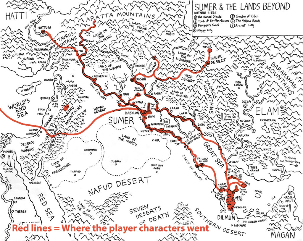
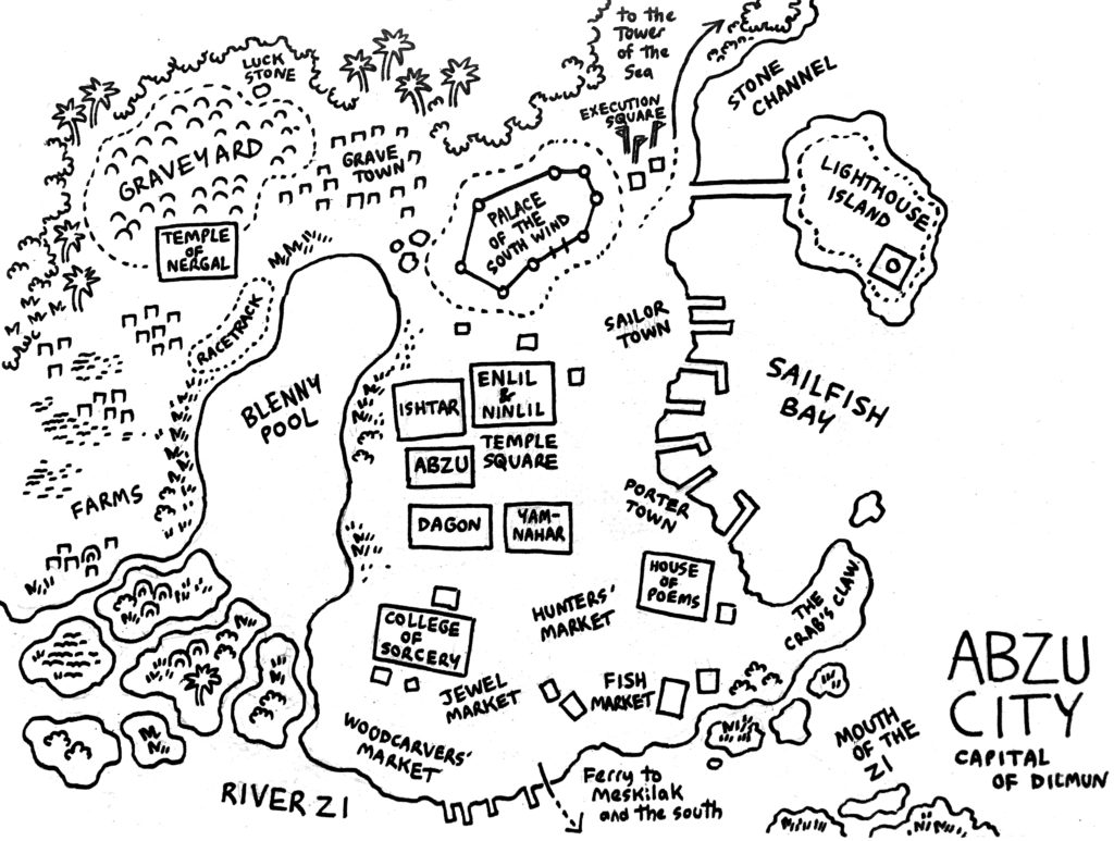
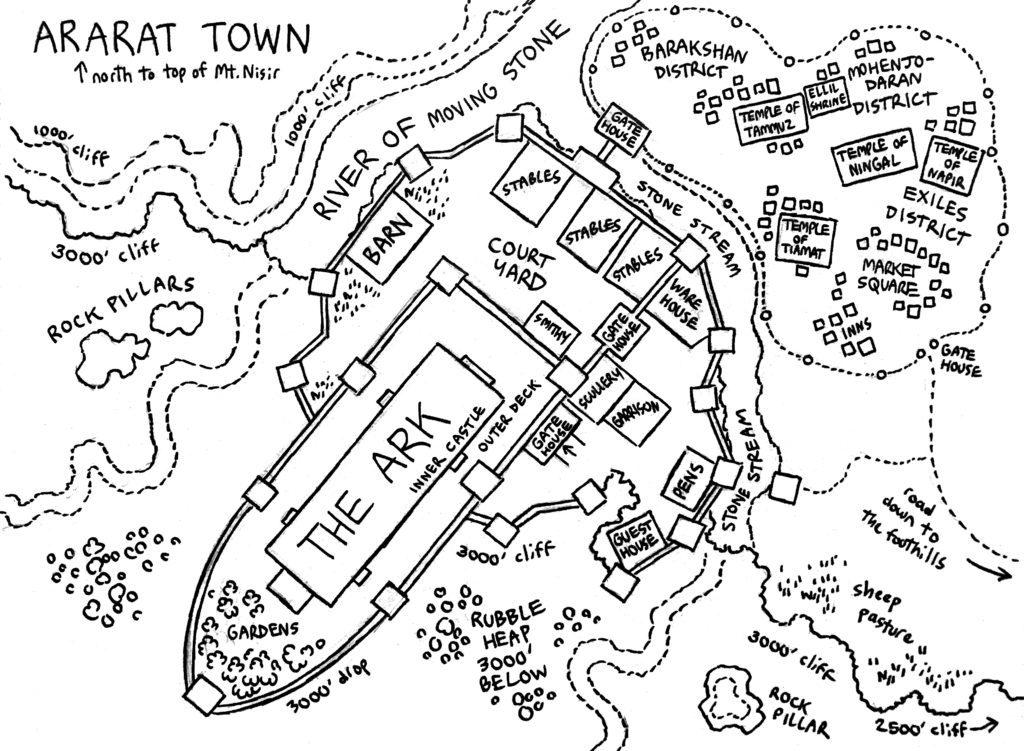
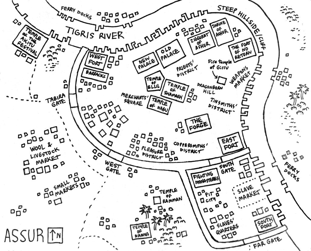
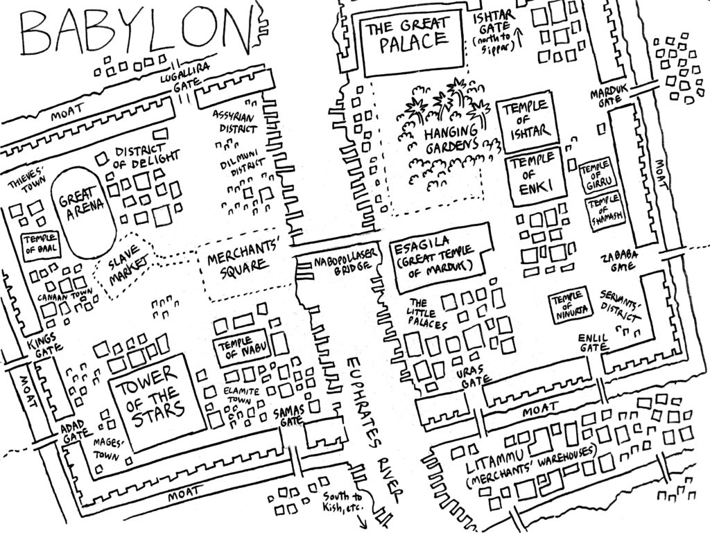
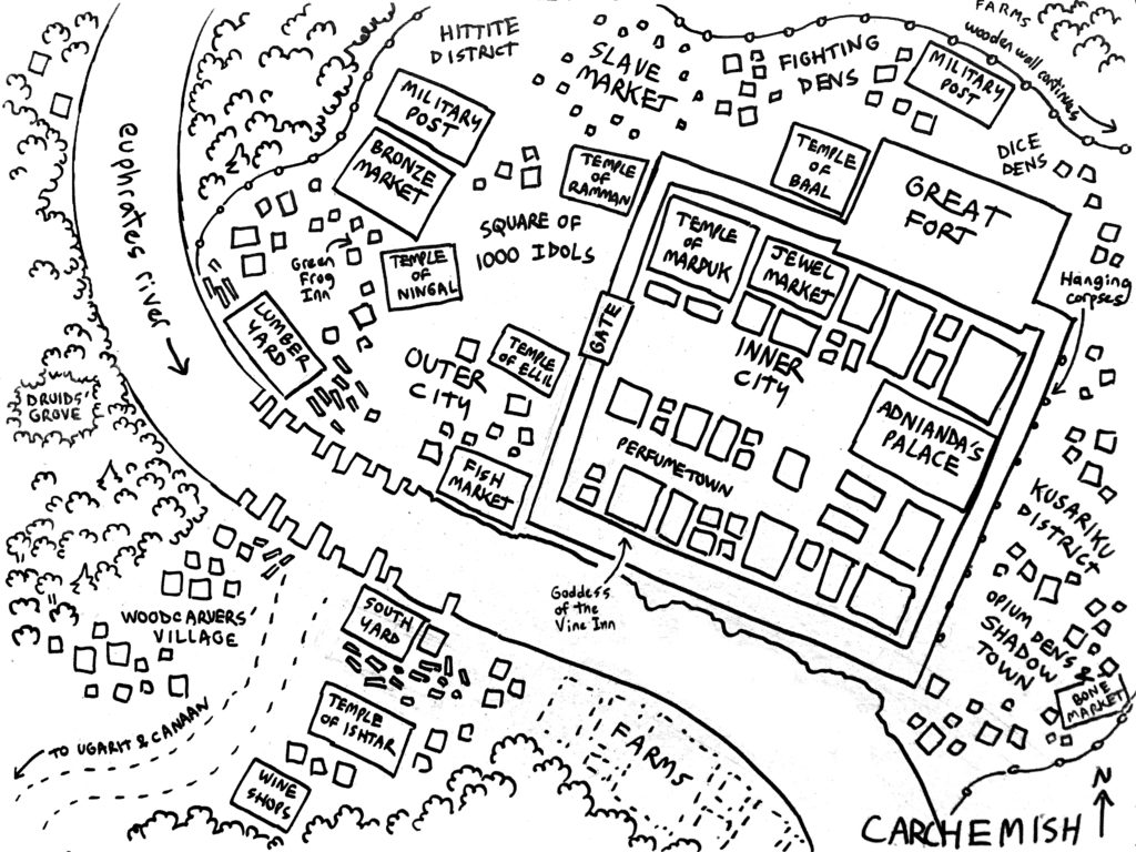
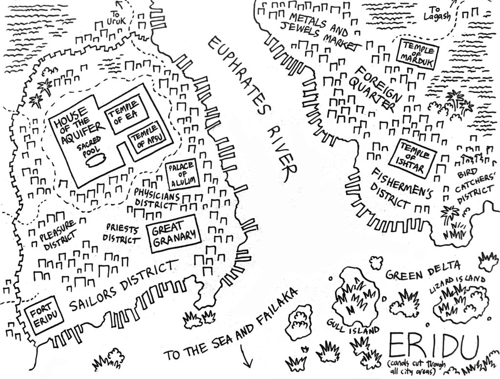
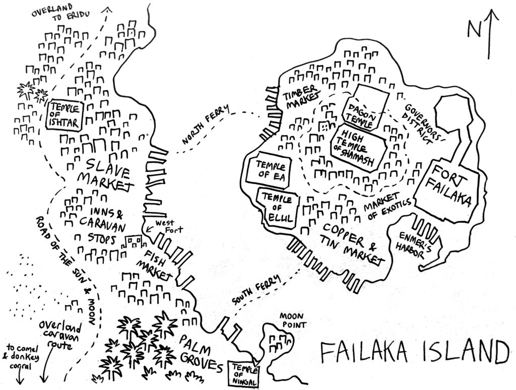
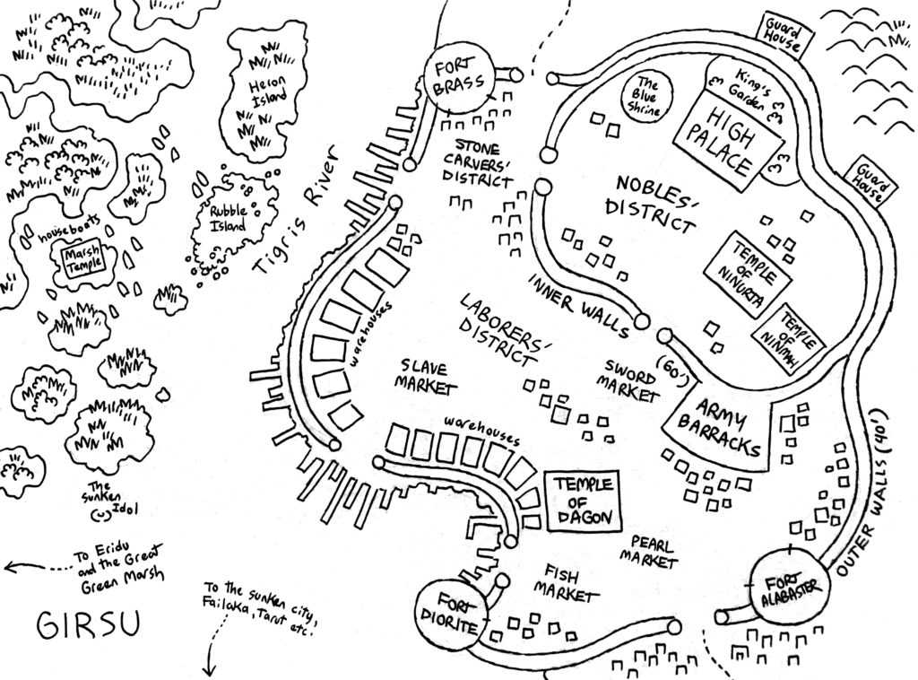
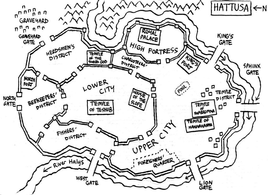
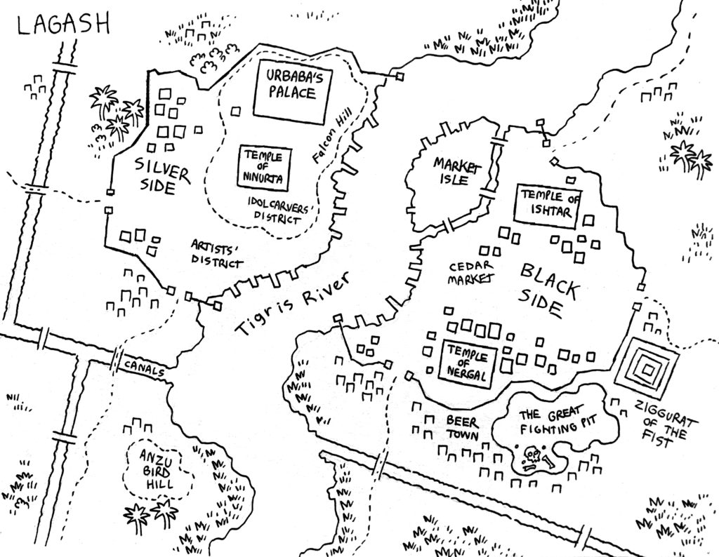
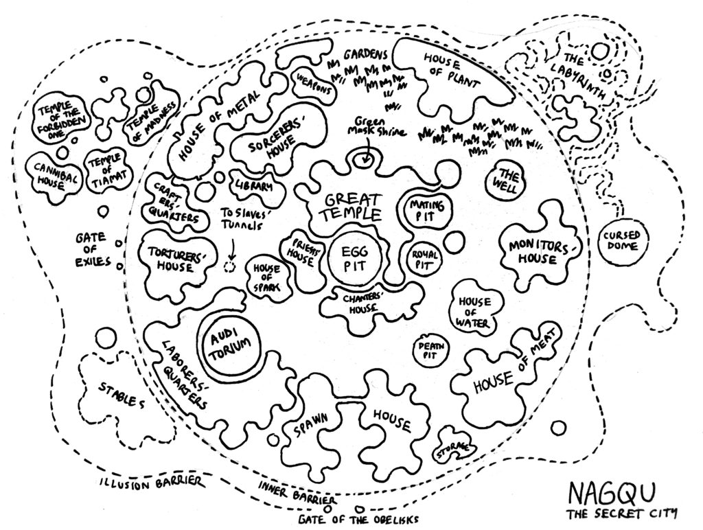
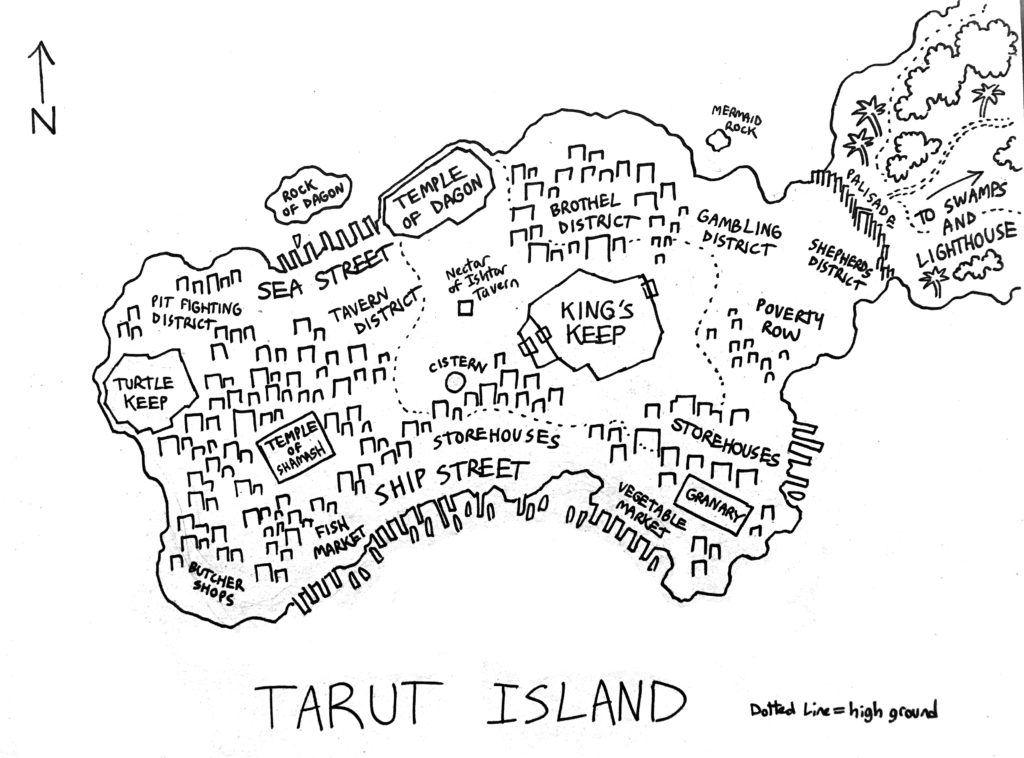
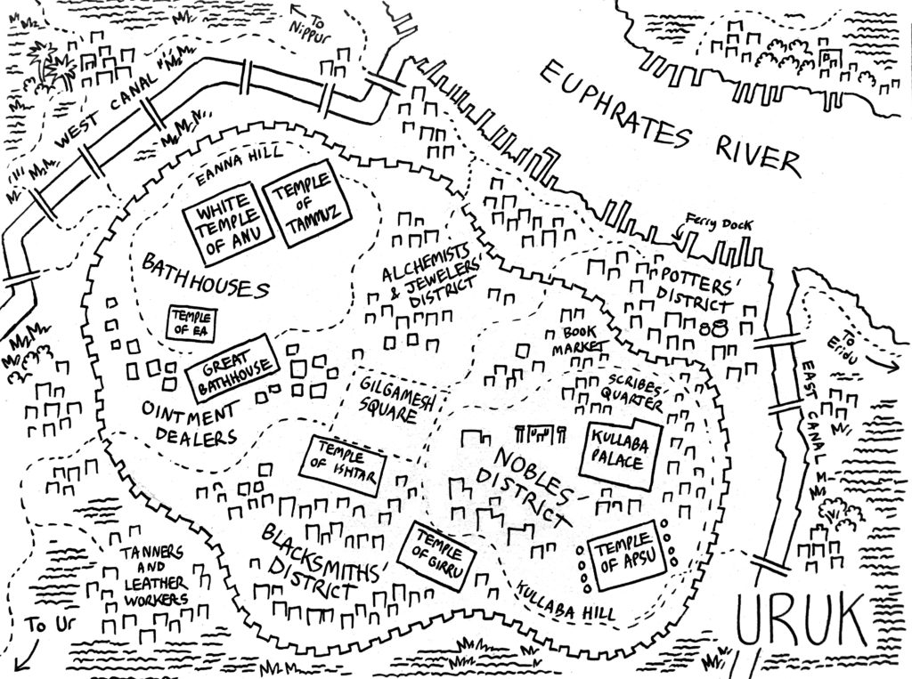
Over the course of the campaign, I drew a lot of maps of the various cities the players passed through. Most were drawn on the backs of 19″x24″ sheets of artboard for easy reference at the table. Of course, walking into a town, the player characters don’t necessarily immediately “know” that here’s the wizards’ school and here’s the temple, but I think it was nice to give players something to look at to make the setting more immersive.
Here are those maps, in case anyone finds them useful! Some of them are also posted on Instagram, Twitter or Facebook.
These maps are mostly completely imaginary, of course, but for the real-world cities (that is, not Nagqu or Ararat) I started with historical info when possible before going nuts with the taverns and brothels. There’s little data available for most of these places, but Hattusa and Babylon have full 3D reconstructions available online based on archaeological digs (!!), and Colin MacEvedy’s Cities of the Classical World, recommended by Kenneth Hite, had info on Assur and one or two others. This kind of “start with research before completely making up a bunch of nonsense” approach works for me.
If you like my maps, please check out more of them in color at store.mockman.com! (plug plug)
That’s about all I can write about “Dragons of Babylon”. For my next post, I’ll write about my current RPG, Dreamland.